


1
2
3
4
5
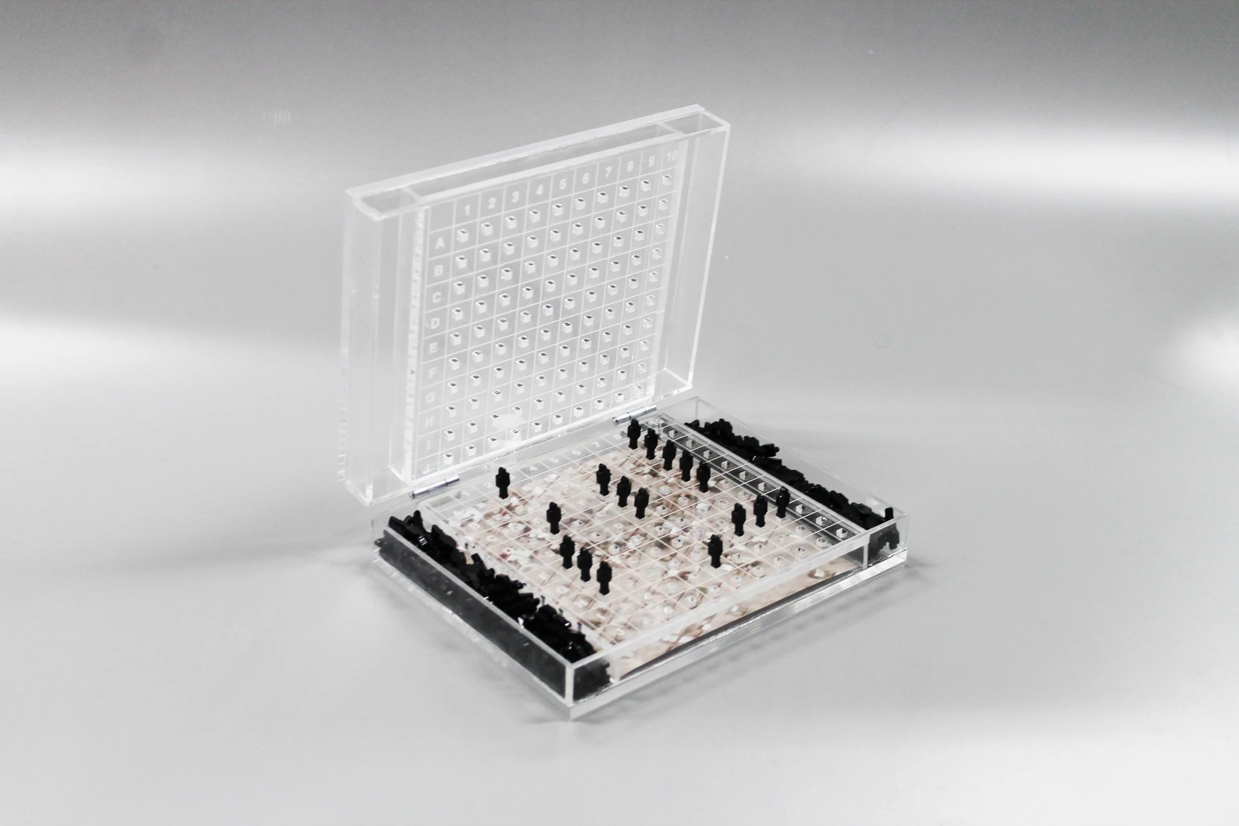
Censor-ship adopts the framework of the game Battleship and redefines the way in which we use maps to geolocate and maintain visibility in areas the have been attacked by US drones. The aerial view is harnessed as the quintessential vantage point for drones and for the public to form relationships with the imagery of these places but also the sometimes delayed satellite footage to document the destruction. Essentially these technological platforms provide the only visual evidence accessible to the universal public in contextualizing these landscapes. Gaining perspective through vertical angles speaks to the accessibility of imagery but also the censorship of these stories, lives, places and grief. This becomes a question of how surveillance and the gaze has moved past human lines of sight and been implemented into satellite based combat and reinterpreted into militarized gaming. There is a strong attempt to reconnect with the land while always being struck with the limitations of the satellites to relay accurate and recent visual information. With the loss of the horizon line the audience begins to consider not only the almost god-like view that this kind of footage allows, but the divinely distant quality within militant warfare.
Landscapes of Yemen, Somalia and Pakistan screen captured from Google Earth at the closest date to when the missile strike occurred are logged and can be inserted interchangeably behind the battle platform grid. The missiles when inserted into the grid transform into forms that are vaguely human, a clear reminder of not only the landscapes destruction but the unidentifiable and often anonymous casualties from such a distance.